- Photos & Map
How would you like to arrive?
- Website
- Details
- Useful Information
- Nearby
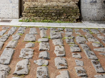
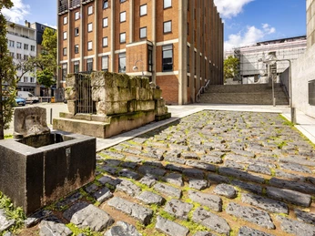
During the construction of the Romano-Germanic Museum, the 65 m long section of a Roman road came to light that led to the harbour of the Roman city. This was located, of all places, where the entrance for the underground car park under the Domplatte was planned. The section of road that is visible today and has been shortened to 33 m was therefore moved 6 m southwards.
Photos document that the section of road that was found was in a better condition than after it had been moved to its present location. The stones fitted together better than they do today and a bend in the road which allowed water to drain away has also been straightened. Nevertheless, the harbour road is a beautiful illustration of Roman engineering and planning and a section of the approximately 100,000 km long road network in the Roman Empire. It was precisely this road network that, starting from Rome, made possible the conquest and development of the Mediterranean region and a large part of Europe.
Photos document that the section of road that was found was in a better condition than after it had been moved to its present location. The stones fitted together better than they do today and a bend in the road which allowed water to drain away has also been straightened. Nevertheless, the harbour road is a beautiful illustration of Roman engineering and planning and a section of the approximately 100,000 km long road network in the Roman Empire. It was precisely this road network that, starting from Rome, made possible the conquest and development of the Mediterranean region and a large part of Europe.
Useful Information
Eligibility
Suitable for any weather
for Groups
for Class
for families
for individual guests
Suitable for the Elderly
Parking facilities
The section of the Roman harbour road is located next to the Roman-Germanic Museum in the vicinity of Cologne Cathedral at Roncalliplatz. The distance to the main railway station is 500 m.
Nearby


